Tag: Flintshire

  • A Morning at Mostyn

    (Sunday 24th May, 2026)

    We were down at Mostyn this morning, looking over towards the Wirral Peninsula from the Flintshire side of the Dee Estuary. Bright and sunny, the temperature was still pleasantly comfortable at 23°C and the wind (SSW) barely noticeable. Although the temperature climbed during the afternoon, it was still much lower than those expected over the next few days. [Note: the UK May Bank Holiday heat record was broken at Kew Gardens in London the following day, where the temperature reached 34.8°C. It was exceptionally warm throughout most of the UK and locally temperature of 32.2°C was recorded at Hawarden Airport, just twenty miles away. Such temperatures would have been a bit too much for us pair of old duffers, we reckon].
    pathmost

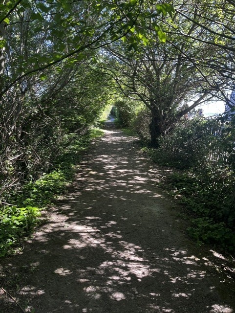
        We parked up near Abakhan Stores and followed the narrow path towards the rear of the buildings. Several Goldfinches darting from tree to tree either side of the us as we progressed: the collective noun for Goldfinches is a charm, the word deriving from the Old English word c’irm which describes the chattering sound they make. Apparently, the birds are not particularly charming in the modern sense, but we love them all the same![1]
    Dogrose2

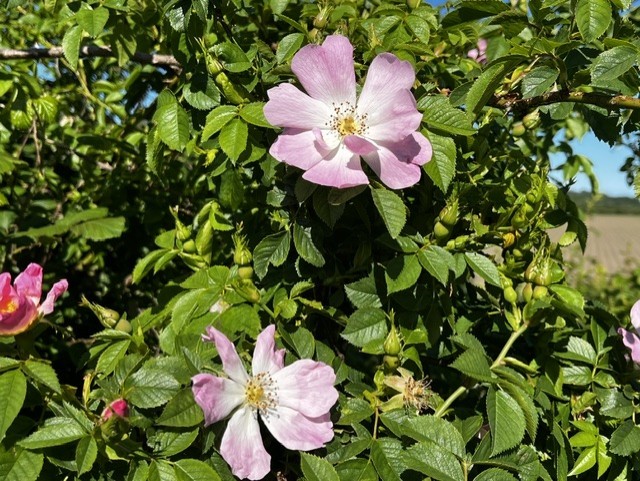
    Dog roses

        Either side of this path are fields with irrigation ditches running along the bottom. And where there’s water, of course, there are insects, which in turn attract the birds. Above the field to our left, two House martins displayed their aerial acrobatics as they fed on the wing, one moment carving wide graceful arcs through the sky, the next moment adeptly feinting left and right at seemingly impossible angles to catch their prey unawares. Wonderful to watch!
    Lancaster

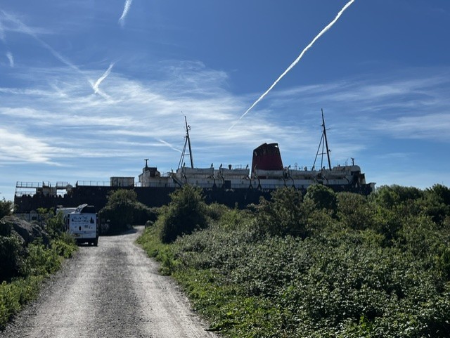
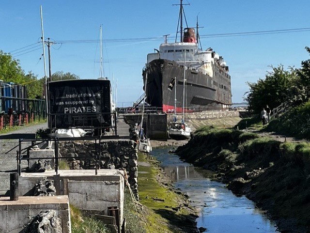
    TSS Duke of Lancaster

        At the bottom of the path lies the TSS Duke of Lancaster which is fenced off and has lain beached down here since 1979. The ship was originally built in the mid-1950s for British Railways which, at the time, operated ferry services as well as trains. The TSS Duke of Lancaster primarily served passengers travelling between Heysham, in Lancashire, and Belfast. You can find more detailed information about the ship’s history on Wikipedia.[2]
    Lancaster2

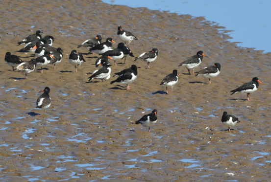
        Looking out over the Dee Estuary, we saw a large flock of Oystercatchers making the most of low tide and using their distinctive orange beaks to forage in the mudflats nearby.
    Oyster2
    Oystercatchers
    Oysteragain

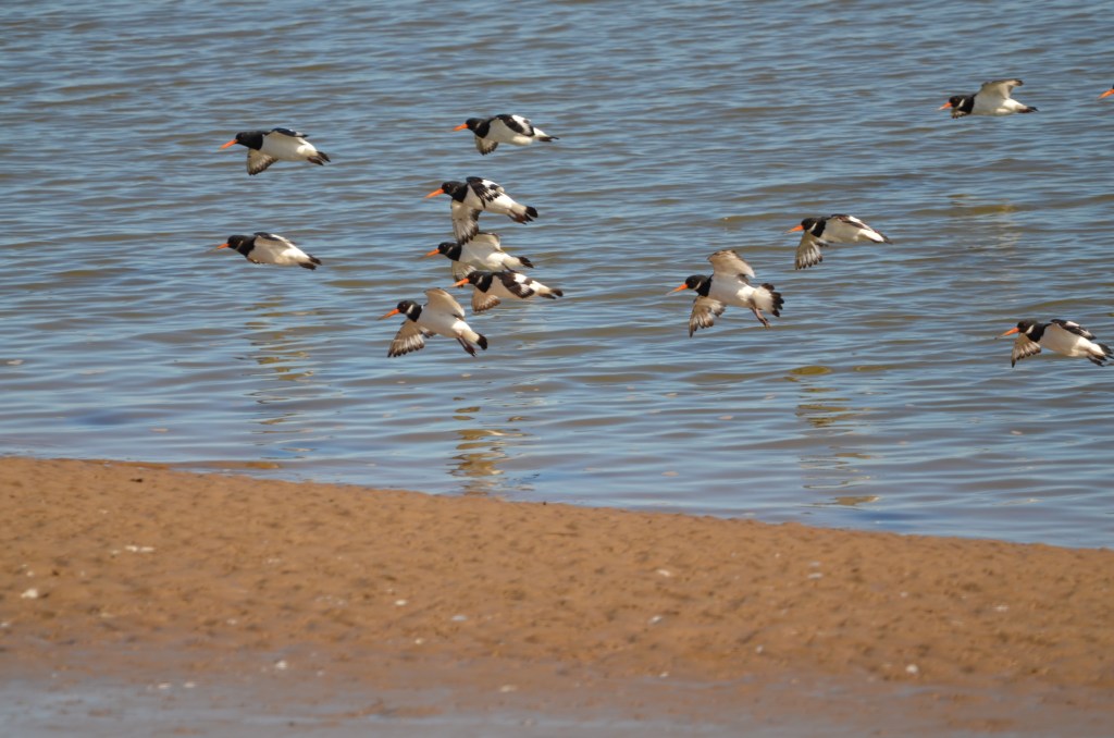
    Oystercatchers

    Occasionally, a group of them would take to the air at some unseen signal and fly out to a sandspit further out into the wide expanse of the estuary, returning in similar fashion later. (At its mouth, the Welsh and the English sides of the Dee Estuary are about five miles apart).
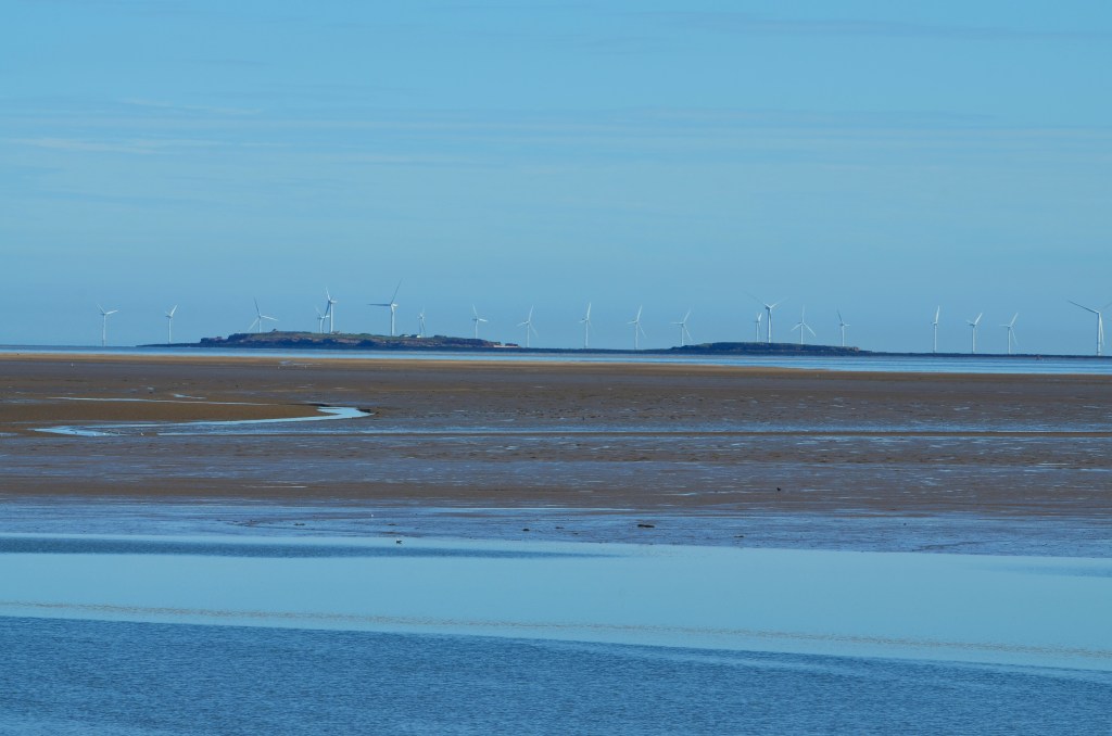
    Hilbre

    Looking towards Hilbre Island near the Wirral side of the Dee Estuary

    A Grey heron flew in and began hunting for food in the shallows. It stood motionless for minutes on end before spearing its unfortunate prey with a lightning strike of its beak.
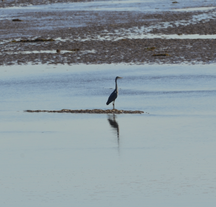
    Reflective heron

    Above: A reflective Grey heron; and, below: a Herring gull
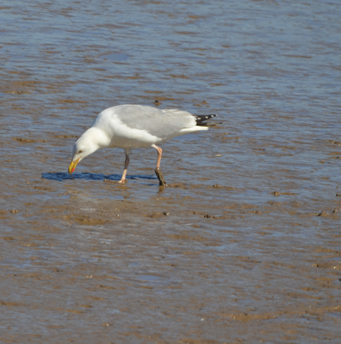
    Herring gull

        As we set off back along the path on our return journey, Stu pointed towards the irrigation ditch and said: “Kingfisher!” I turned round and, but I only saw the distinctive electric-blue and turquoise of its back as it flew away from us along the ditch. We stayed for a while, scanning the area with our binoculars and, eventually, managed to locate it quite some distance away in a tree overhanging the water. We were just able to pick out the turquoise / blue of its feathers from the surrounding tree foliage before it moved off again. No photographs but great to see and we now have a reasonable idea of its territory.

        We were accompanied by our Goldfinch friends on the way back along the path and we clocked a rabbit at the edge of the field on the opposite side to the ditch, where there is a small thicket bordering the field. Whether it sensed danger or not, the rabbit decided to retreat back undercover.
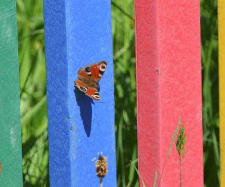
    Peacock butterfly

    Peacock butterfly taking the sun

    The important stuff

        Well, after all this excitement, we were in dire need of refreshment. So we sauntered off to the cool and spacious Café at Abakhan where we partook of a cappuccino each and a Caramel Slice (Col) and Coffee and Walnut cake (Stu).
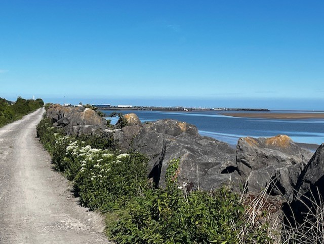
    Dee-estuary

    [1] From Living with Birds https://www.livingwithbirds.com/tweetapedia/21-facts-on-goldfinch

    [2] https://en.wikipedia.org/wiki/TSS_Duke_of_Lancaster

  • The Rivers Dee

        Until recently, I thought that there were two rivers known as the River Dee – one in Scotland, and one in Wales (which is the one, plus its estuary, that this blog, The Dee and Thereabouts, centres on). But I’ve recently learned that altogether, there are five rivers named Dee: two in Scotland, one in Cumbria, one in Wales, and one in the Republic of Ireland.

    River Dee, Aberdeenshire, Scotland.

        This River Dee begins in an area of the Cairngorm Mountains known as the Wells of Dee. It’s the highest source of any river in the British Isles, the river source’s plateau being approximately 1,220 metres high. The river is 87 miles long and flows through Aberdeenshire, eventually spilling out into the North Sea at Aberdeen Harbour.

    River Dee, Dumfries and Galloway, Scotland.

        Another Scottish River Dee, this time in the south-west of the country. The river originates at Loch Dee in the Galloway Hills. It travels for 38 miles before reaching Kirkcudbright and then discharging into the Solway Firth on the Irish Sea.

    River Dee, Cumbria, England.

        This River Dee is formed by several smaller streams radiating from Blea Moor Moss, in the Yorkshire Dales National Park, in Cumbria[1]. The river travels through Dentdale, which takes its name from the village of Dent ,and flows for about ten miles before joining the River Rawthey, near the town of Sedbergh. (The River Rawthey is in turn a tributary of the River Lune, which eventually – after 50 odd miles – empties into Morecombe Bay).

    River Dee, Republic of Ireland.

        This River Dee flows from Bailieborough (Bailieboro) in County Cavan for 37 miles through County Meath and County Louth. The river joins the River Glyde at Annagassan village in County Louth, and both of these rivers then form a short confluence before they discharge into Dundalk Bay on the east coast of Ireland, out to the Irish Sea.

    River Dee (Afon Dyfrdwy in Welsh), Wales.  

        This River Dee flows through several counties in North Wales: namely, Gwynedd, Denbighshire, Wrexham County Borough, and Flintshire; and briefly enters England at points in Shropshire and Cheshire. The Dee Estuary acts as a natural dividing line between the western side of the Wirral Peninsula, in England, and the eastern side of Flintshire, in Wales.

        The River Dee’s source is on the mountain of Dduallt in Snowdonia, at about 450 metres high. The 68 miles of river flows through Bala Lake (Llyn Tegid), Corwen, Llangollen, Bangor-on-Dee, Farndon, and Holt. Once it reaches Chester, the River Dee becomes tidal and is noteworthy for its tidal bore which is usually produced during a spring or autumnal equinox, although tidal bores may occur at any time of the year if conditions are favourable.

    River Dee at Chester

        The River Dee at Chester…

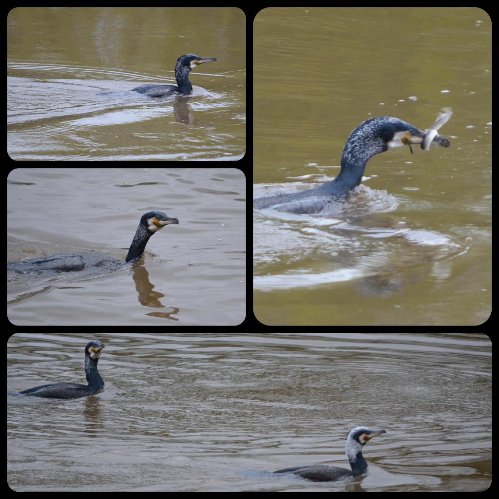
    Cormorant at Chester

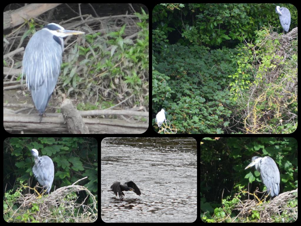
    …and some local residents. (Above: Cormorants. Below: Grey heron

    Grey heron at Chester

    After Chester, the river crosses the border to Saltney, which lies mostly in Wales, although some of the town is in England, as the aptly named Boundary Lane reminds us. (Here, the border technically runs down the middle of the road! This is the only suburban street which divides England and Wales in this way). The River Dee travels on past Queensferry to Connah’s Quay, where it opens out into the Dee Estuary. The estuary itself is about 12 miles long and 4.5 to 5 miles wide: note that these are approximate figures, as information varies, depending on which sources you look at.

        Towns on the Welsh side of the estuary include Flint, Holywell, and Mostyn. On the Wirral side of the estuary, lie Neston, Parkgate, Heswall, West Kirby and Hoylake. Just north of Talacre in Flintshire is the Point of Ayr, which is the northernmost tip of Wales, and between here and Hilbre Point, near Hoylake and West Kirby on the north-west of Wirral Peninsula is where the Dee enters Liverpool Bay on the Irish Sea.

    Hilbre

    Looking towards Hilbre Island from Mostyn on the Welsh side of the Dee Estuary

        From Chester to Connah’s Quay, the Dee has a very straight ‘canalised’ section. This artificial channel was dug out by Dutch engineers between 1732-36 in an attempt to return Chester to its historic importance as a port. However, this was only partially successful as the River Dee eventually silted up again. The work also effectively diverted the river away from places it once meandered around, including Blacon, Saughall, Shotwick, Burton, and Parkgate. 

    Further reading

    Much of the information for each of these Dee rivers was gained from just looking at the various maps available on Google Maps, OS maps, and Wikipedia. I also found the following sources useful:

    https://chester.shoutwiki.com/wiki/River_Dee

    https://www.keithatkinson.me.uk/history-of-shotton/5-the-river-dee-the-latchcraft-pits/

    https://www.liverpool.ac.uk/~cmi/dee/dee1870.html

    https://ntslf.org/tides/about-tides/tidal-river-bores

    https://www.parkgatesociety.co.uk/


    [1] I take a childish pleasure in reporting that there is a Mossy Bottom as well as a Hazel Bottom near Blea Moor Moss. And there you were, thinking I was all grown up!