Category: Rivers

  • Above the Dee Valley

    (Sunday 10th May, 2026)

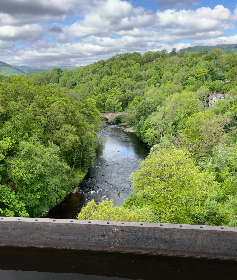
    39 metres (127 feet in old money) above the Dee Valley to be more accurate. Yes, we went over to Pontcysyllte Aqueduct in Wrexham County Borough this morning. Although the sun popped out occasionally to remind us of its existence, the temperature struggled to get any higher than 12°C which seemed colder at height. Still, it was a reasonably bright day and we had some magnificent views from our vantage point in the sky!

    road bridge

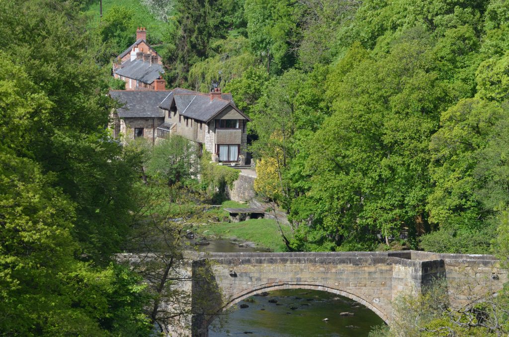
    Looking down at Cystylltau Bridge, which was constructed during the 17th century.

    Berwyn Railway Viaduct

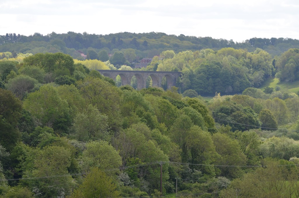
    Looking west towards Berwyn Railway Viaduct

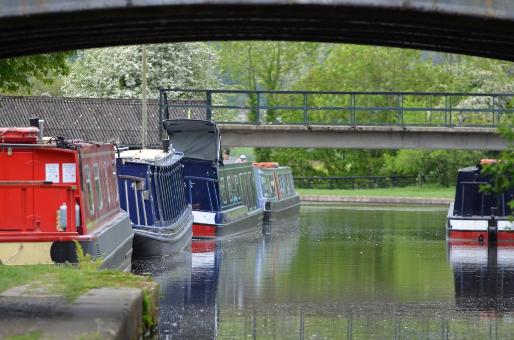
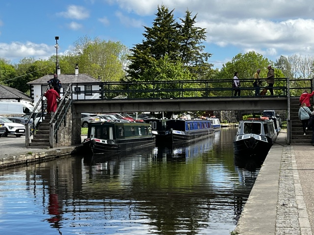
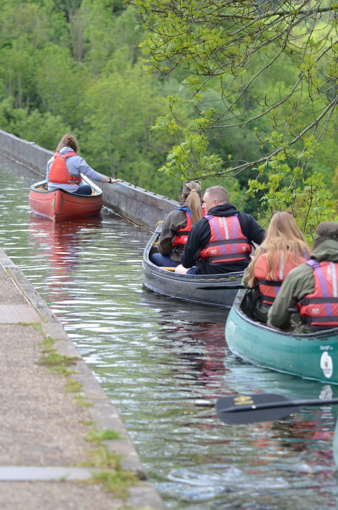
        The aqueduct carries the Llangollen Canal across the valley and, as you’d expect, this particular stretch of water is popular with narrowboats although, today, we saw two teams of canoeists crossing over as well. There is a towpath on one side of the aqueduct, providing great views over the River Dee as it courses through the valley below, and this was busy with people crossing from both sides.

    Dog being chauffered

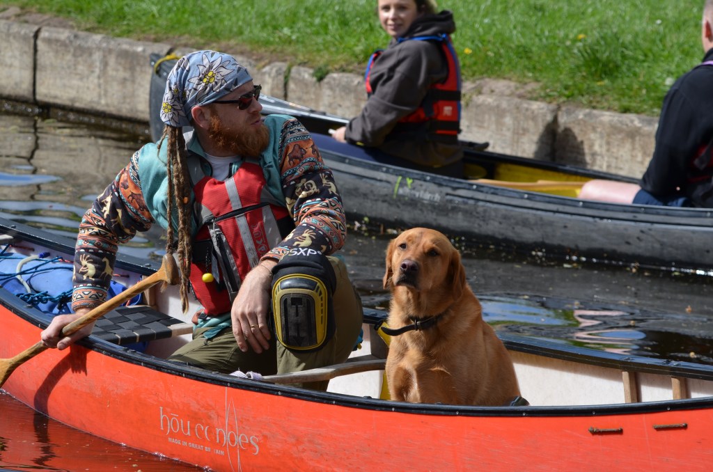
        This dog is clearly used to being chauffered across the aqueduct.

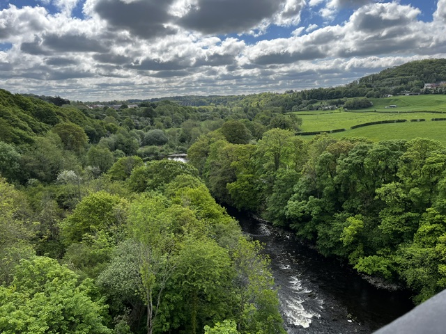
    It certainly makes a difference looking down on the green tree canopy below, rather than leaning back and looking up. As you can see from the photographs, the foliage is absolutely flourishing everywhere.

    Dee Valley 2

        The cast-iron trough that carries the water has to be cleaned and maintained of course. This happens every five years: each end is closed and a plug opened to drain the water into the River Dee below. It’s basically the same as emptying your bath at home, although this is a slightly bigger bath!

    Sculpture

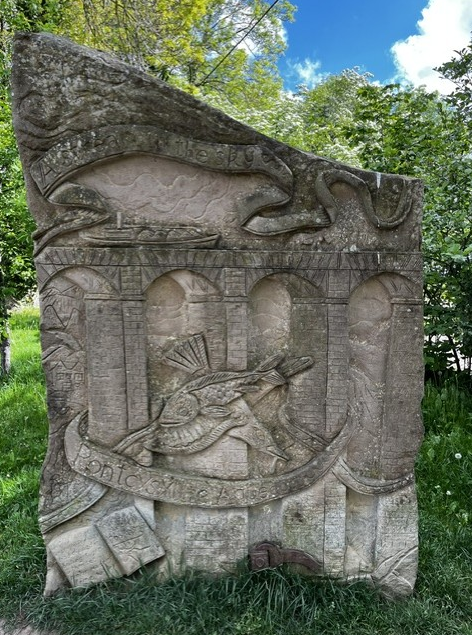
    The words on this sculpture by Anthony Lysycia are from Sir Walter Scott who had described the aqueduct as ‘the stream in the sky’. Scott had also wondered how fishes could swim above flying birds, hence the central depiction.  

    Narrowboats moored

        Thomas Telford and William Jessop get the credit for building the aqueduct, although they did get a little bit of assistance from the more than 500 men that were also involved in the work over a period of ten long years. There’s a little museum at one end of the aqueduct where you can learn all about its history. Quite fascinating.

    Boats reflected

        While there are railings on the towpath side, there aren’t over the far side: I’ve been over in a narrowboat only the once and remember looking out of the window and not seeing anything other than sky on that one side! It really was a thrilling experience (a bit hairy, to be honest). The aqueduct is well worth a visit, whatever form of transport you opt for.

    Dee Valley

    Although holes were drilled to take railings, they were never actually added to the far side of the canal’s cast-iron trough.

    Gripping the edge

    While this looks like you’d get a close view of the valley below, it might not be to everyone’s taste!

  • The Rivers Dee

        Until recently, I thought that there were two rivers known as the River Dee – one in Scotland, and one in Wales (which is the one, plus its estuary, that this blog, The Dee and Thereabouts, centres on). But I’ve recently learned that altogether, there are five rivers named Dee: two in Scotland, one in Cumbria, one in Wales, and one in the Republic of Ireland.

    River Dee, Aberdeenshire, Scotland.

        This River Dee begins in an area of the Cairngorm Mountains known as the Wells of Dee. It’s the highest source of any river in the British Isles, the river source’s plateau being approximately 1,220 metres high. The river is 87 miles long and flows through Aberdeenshire, eventually spilling out into the North Sea at Aberdeen Harbour.

    River Dee, Dumfries and Galloway, Scotland.

        Another Scottish River Dee, this time in the south-west of the country. The river originates at Loch Dee in the Galloway Hills. It travels for 38 miles before reaching Kirkcudbright and then discharging into the Solway Firth on the Irish Sea.

    River Dee, Cumbria, England.

        This River Dee is formed by several smaller streams radiating from Blea Moor Moss, in the Yorkshire Dales National Park, in Cumbria[1]. The river travels through Dentdale, which takes its name from the village of Dent ,and flows for about ten miles before joining the River Rawthey, near the town of Sedbergh. (The River Rawthey is in turn a tributary of the River Lune, which eventually – after 50 odd miles – empties into Morecombe Bay).

    River Dee, Republic of Ireland.

        This River Dee flows from Bailieborough (Bailieboro) in County Cavan for 37 miles through County Meath and County Louth. The river joins the River Glyde at Annagassan village in County Louth, and both of these rivers then form a short confluence before they discharge into Dundalk Bay on the east coast of Ireland, out to the Irish Sea.

    River Dee (Afon Dyfrdwy in Welsh), Wales.  

        This River Dee flows through several counties in North Wales: namely, Gwynedd, Denbighshire, Wrexham County Borough, and Flintshire; and briefly enters England at points in Shropshire and Cheshire. The Dee Estuary acts as a natural dividing line between the western side of the Wirral Peninsula, in England, and the eastern side of Flintshire, in Wales.

        The River Dee’s source is on the mountain of Dduallt in Snowdonia, at about 450 metres high. The 68 miles of river flows through Bala Lake (Llyn Tegid), Corwen, Llangollen, Bangor-on-Dee, Farndon, and Holt. Once it reaches Chester, the River Dee becomes tidal and is noteworthy for its tidal bore which is usually produced during a spring or autumnal equinox, although tidal bores may occur at any time of the year if conditions are favourable.

    River Dee at Chester

        The River Dee at Chester

    Cormorant at Chester

    …and some local residents. (Above: Cormorants. Below: Grey heron

    Grey heron at Chester

    After Chester, the river crosses the border to Saltney, which lies mostly in Wales, although some of the town is in England, as the aptly named Boundary Lane reminds us. (Here, the border technically runs down the middle of the road! This is the only suburban street which divides England and Wales in this way). The River Dee travels on past Queensferry to Connah’s Quay, where it opens out into the Dee Estuary. The estuary itself is about 12 miles long and 4.5 to 5 miles wide: note that these are approximate figures, as information varies, depending on which sources you look at.

        Towns on the Welsh side of the estuary include Flint, Holywell, and Mostyn. On the Wirral side of the estuary, lie Neston, Parkgate, Heswall, West Kirby and Hoylake. Just north of Talacre in Flintshire is the Point of Ayr, which is the northernmost tip of Wales, and between here and Hilbre Point, near Hoylake and West Kirby on the north-west of Wirral Peninsula is where the Dee enters Liverpool Bay on the Irish Sea.

        From Chester to Connah’s Quay, the Dee has a very straight ‘canalised’ section. This artificial channel was dug out by Dutch engineers between 1732-36 in an attempt to return Chester to its historic importance as a port. However, this was only partially successful as the River Dee eventually silted up again. The work also effectively diverted the river away from places it once meandered around, including Blacon, Saughall, Shotwick, Burton, and Parkgate. 

    Further reading

    Much of the information for each of these Dee rivers was gained from just looking at the various maps available on Google Maps, OS maps, and Wikipedia. I also found the following sources useful:

    https://chester.shoutwiki.com/wiki/River_Dee

    https://www.keithatkinson.me.uk/history-of-shotton/5-the-river-dee-the-latchcraft-pits/

    https://www.liverpool.ac.uk/~cmi/dee/dee1870.html

    https://ntslf.org/tides/about-tides/tidal-river-bores

    https://www.parkgatesociety.co.uk/


    [1] I take a childish pleasure in reporting that there is a Mossy Bottom as well as a Hazel Bottom near Blea Moor Moss. And there you were, thinking I was all grown up!